
55,00 €
Map of Spain with provinces and major cities (over 10000 citizens)
Digital map of Spain with regional and provincial boundaries, municipalities and all the towns with more than 10,000 inhabitants.
(...) Read more »
ArcView Shapefile (.shp)

59,99 €
Maps of 17 Autonomous Communities of Spain
Separated vector file for all Spanish Autonomous Communities. Map files contains a lot of political information, such as roads and cities. Also includes a TIFF images relief.
Adobe Illustrator, Acrobat PDF, TIFF

Ask price
Maps of 50 Provinces of Spain
Digital maps of the 50 Spanish provinces.
(...) Read more »
Adobe Illustrator, Acrobat PDF

90,75 €
Maps of 50 spanish provinces with municipalities and their capitals
Digital maps of the 50 Spanish provinces, each one in a separate file, with the municipal boundaries, capitals, cities and towns organised according to their number of inhabitants.
(...) Read more »
Adobe Illustrator, Acrobat PDF

125,00 €
Northern roadmap of Spain
Vector file map of Cantabria, Basque Country, Navarra, La Rioja and Aragón Autonomous communities of Spain, with all cities and roads, railroad, principal rivers and lakes and other relevant politica
(...) Read more »
Adobe Illustrator, Acrobat PDF

55,00 €
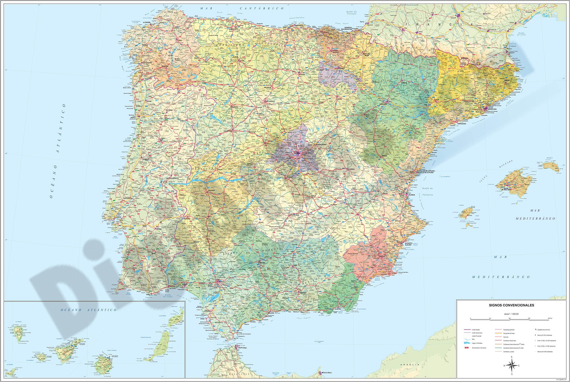
Relief map of Spain
Digital physical-political map of Spain, with the limits and colours of the Autonomous Communities and provinces, large names of capitals and important towns, geographical names and a shaded and colou
(...) Read more »
Adobe Illustrator, Acrobat PDF, TIFF
79,00 €
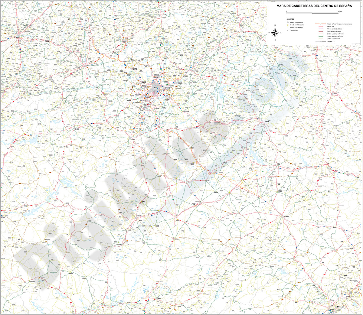
Roadmap of center Spain
Detailed digital map of Center of Spain, include the Autonomous communities of Castilla–La Mancha (Castile–La Mancha) and Community of Madrid, also the province of Soria. Roadmap and all cities, r
(...) Read more »
Adobe Illustrator, PDF

175,00 €
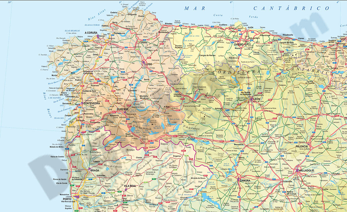
Roadmap of northwestern Spain
Vector file map of Northern and Western Autonomous communities of Spain, with all cities and roads, railroad, principal rivers and lakes and other relevant political information. Scale 1:300.000.
Adobe Illustrator, Acrobat PDF

89,00 €
Southeast roadmap of Spain
Digital map of roads and towns in southeastern Spain
(...) Read more »
Adobe Illustrator, Acrobat PDF

55,00 €
Spain and Portugal provinces for PPT
Political map of Spain and Portugal in PowerPoint format. The map shows the 18 Portuguese mainland districts and their two autonomous regions (Azores and Madeira) and the 17 Spanish Autonomous Communi
(...) Read more »
PowerPoint (ppt)

19,95 €
Spain map Autonomous Communities and provinces
Map of Spain in digital format showing 17 autonomous communities, 2 autonomous cities and 50 provinces and their capitals. Fully editable and resizable vector file.
Adobe Illustrator, Acrobat PDF

79,00 €
Spain map with municipalities
Fully editable vector file map of Spain, showing all municipality boundaries and cities.
Adobe Illustrator, PDF

55,00 €
Spain map with municipalities
Digital map of Spain in georeferenced Shapefile format.
Spain vectorisez cartography showing the limits of the autonomous communities, provinces and municipalities.
(...) Read more »
ArcView Shapefile (.shp)
79,00 €
Spain political-relief poster map
Physical-political Spain map. Include a lot of roads, more than 3.500 cities, major rivers and lakes and geographical names. More than 40 fully-editable layers. 1.1.000.000 scale. High-resolution colo
(...) Read more »
Adobe Illustrator, PDF, JPG (300dpi)
