
125,00 €
Northern roadmap of Spain
Vector file map of Cantabria, Basque Country, Navarra, La Rioja and Aragón Autonomous communities of Spain, with all cities and roads, railroad, principal rivers and lakes and other relevant politica
(...) Read more »
Adobe Illustrator, Acrobat PDF

OFFER: 19,95 € | 9,98 €
Map of Honduras
Digital political map of Honduras with the internal administrative division, its 18 departments and capitals.
(...) Read more »
Adobe Illustrator, Acrobat PDF

55,00 €
Zaragoza municipality - Population by Zip Code
NUMBER OF INHABITANTS BY POSTAL CODE OF THE MUNICIPALITY OF ZARAGOZA.
(...) Read more »
Excel

19,95 €
Map of Japan
Digital political map of Japan with internal administrative division, names and capitals.
(...) Read more »
Adobe Illustrator, Acrobat PDF

65,00 €
Alicante province zip code population
Digital map of postcodes of the province of Alicante/Alacant with the number of inhabitants of each area or postal district.
(...) Read more »
Excel, Acrobat PDF

55,00 €
Sant Andreu de Llavaneres - city map
Street map of Sant Andreu de Llavaneres municipality (Comarca of Maresme, province of Barcelona, Autonomous Community of Catalonia, Spain). Digital map contain separate layers of information with urba
(...) Read more »
Adobe Illustrator, PDF
59,99 €
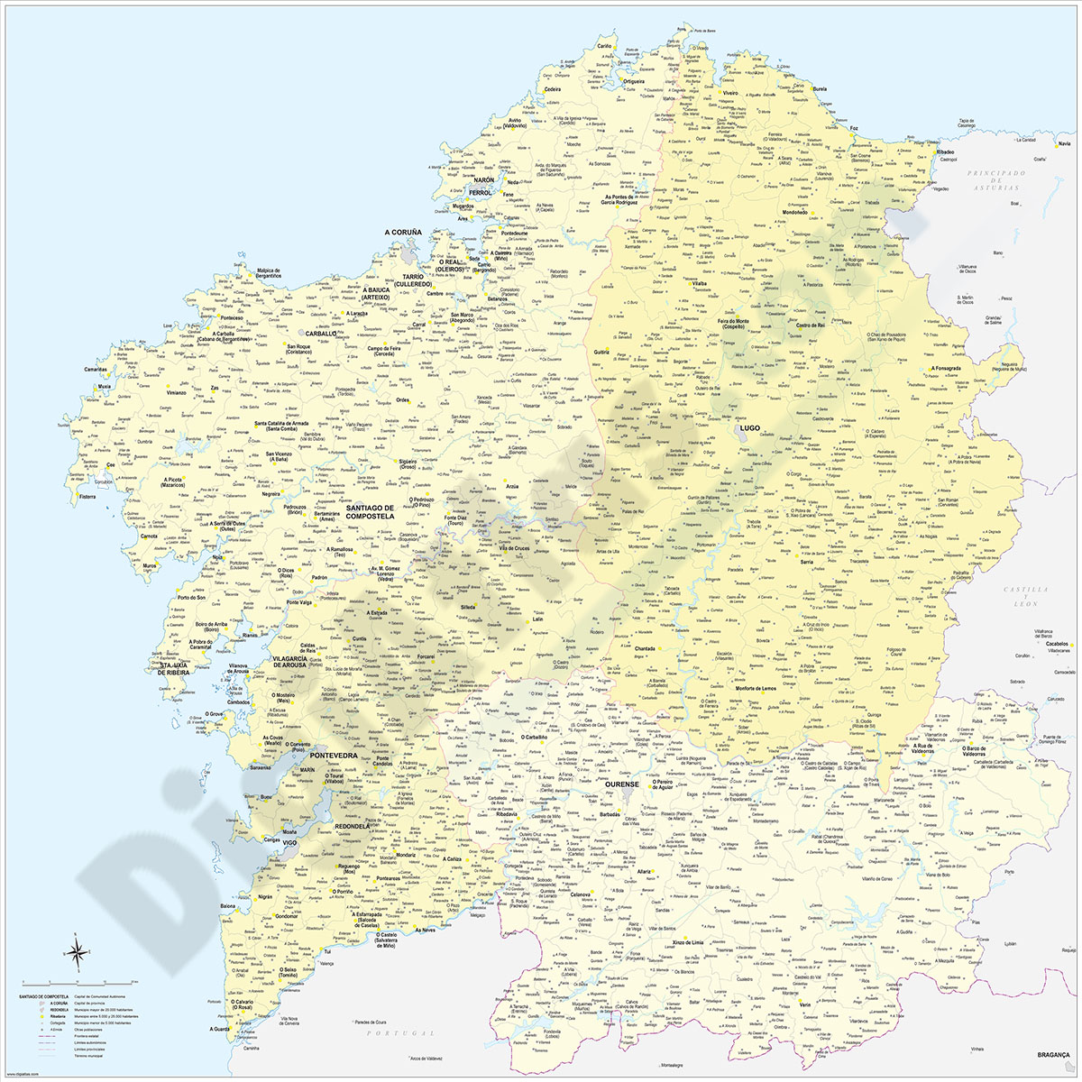
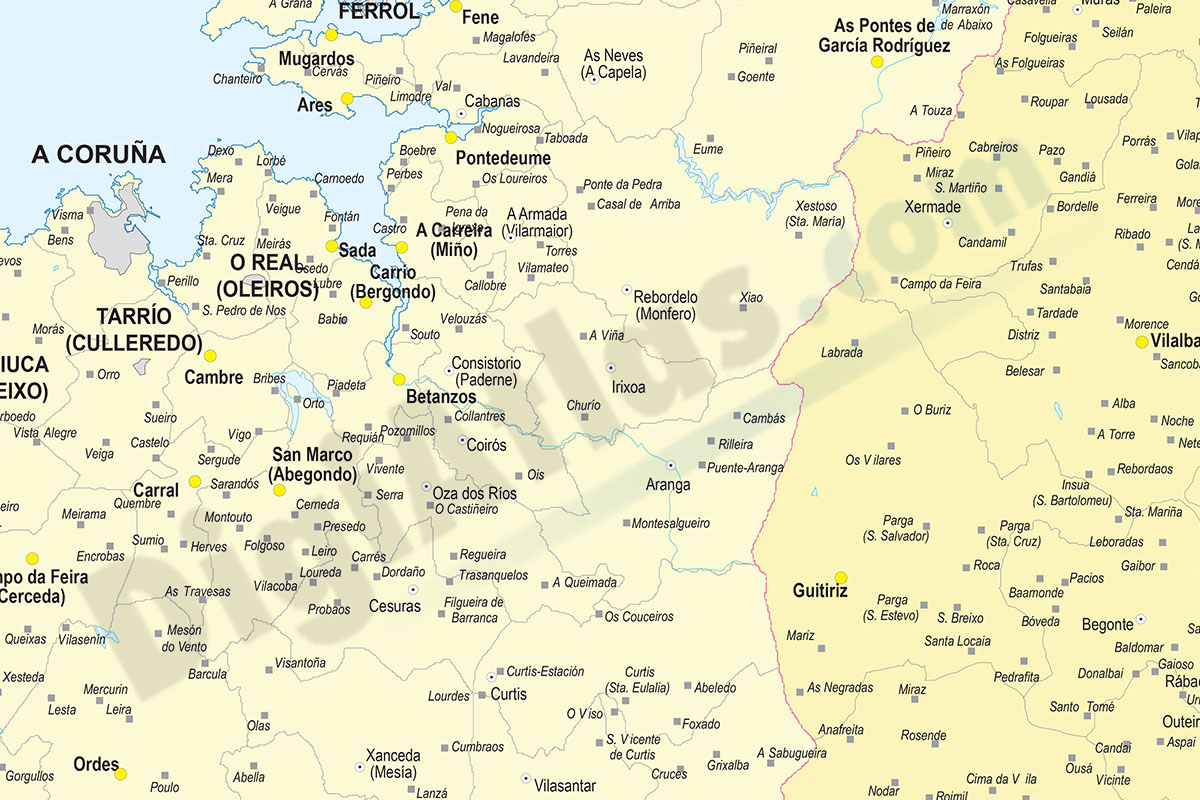
Galicia map with municipalities
Digital map of Galicia autonomous community (northwest Spain) with the municipalities (concellos), their capitals and villages.
(...) Read more »
Adobe Illustrator, Acrobat PDF

19,95 €
Map of Mauritius
Digital political map of the Republic of Mauritius with the internal administrative division (districts and dependencies), their names and capitals.
(...) Read more »
Adobe Illustrator, Acrobat PDF
55,00 €
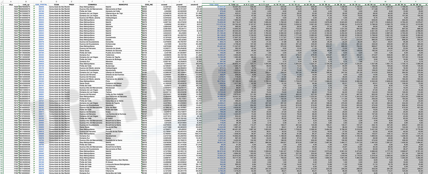
Community of Madrid - Population by Zip Code
NUMBER OF INHABITANTS BY ZIP CODE OF THE COMMUNITY OF MADRID.
Excel file with all the zip codes of the Community of Madrid with population data. Updated to 2024.
(...) Read more »
Excel
65,00 €
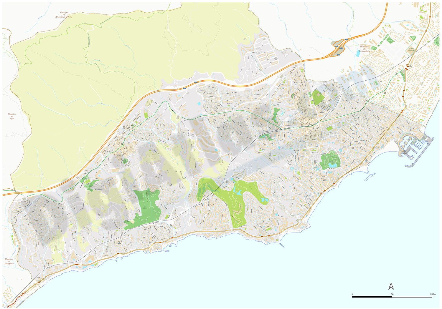
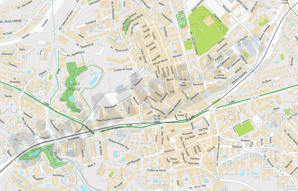
Benalmadena - city map
Digital street map of Benalmádena (province of Málaga, Andalusia) with the delineation of streets and squares, blocks of houses, singular buildings, parks, green areas and names of streets and squar
(...) Read more »
Acrobat PDF

150,00 €
Income and Revenue by Postcode in Spain
Looking to gain valuable insights into income and rental data in Spain? Look no further than our "Excel file with Income and Revenue by Postcode in Spain."
(...) Read more »
Excel

Ask price
Postal Code Finder by Radio
Postcode finder by radius with demographic information.
Ever wanted to easily find postcodes within a certain radius? Our radius postcode finder is your solution. This innovative web application allows you to enter any postcode, town or address in Spain and specify a radius. It then displays all postcodes within that area, along with detailed population, household and income data.
With just a few clicks, you can access a wealth of geographic and demographic information. Our powerful search tool allows pinpoint accuracy in targeting neighbourhoods and regions. Whether you're a business looking to optimise your marketing or a researcher collecting data, this app will show you everything.
Stop wasting time searching for postcodes manually. With our easy-to-use interface, you can instantly generate customised reports for any radius you need. Discover the benefits of location-based reporting now with our radius postcode lookup application.
See less «

55,00 €
Avila - city map center
Digital street map of the city centre of Ávila (Autonomous Community of Castile and León - Spain), with the delineation of streets and squares, blocks of houses, parks and green areas, with colours
(...) Read more »
Adobe Illustrator, Acrobat PDF

59,00 €
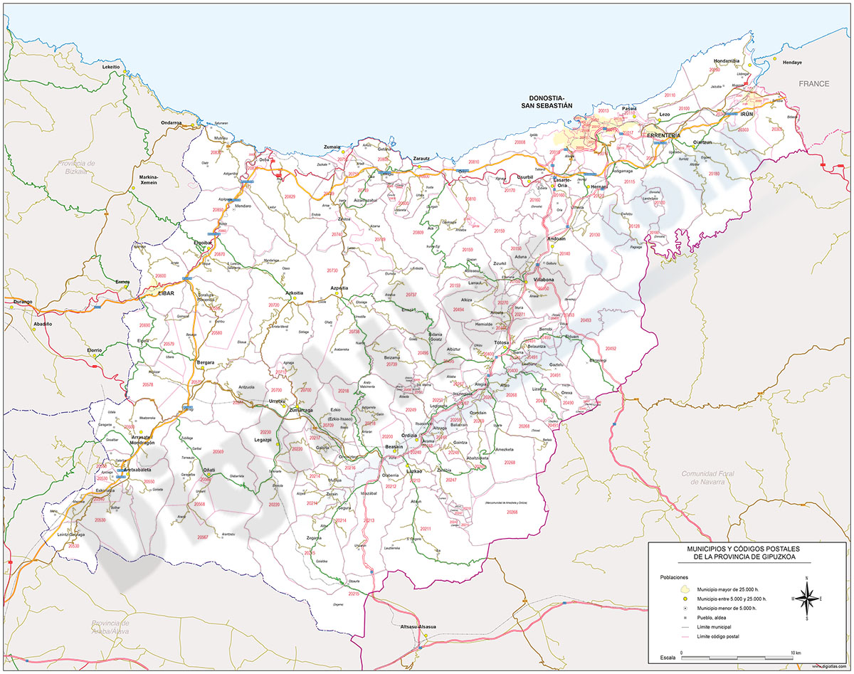
Map of Gipuzkoa province with municipalities and postal codes
Digital map of the province of Gipuzkoa (Basque Country - Spain) with the areas of all 5-digits postal codes, administrative boundaries (state border, autonomous, provincial and municipal boundaries),
(...) Read more »
Adobe Illustrator, Acrobat PDF
59,00 €
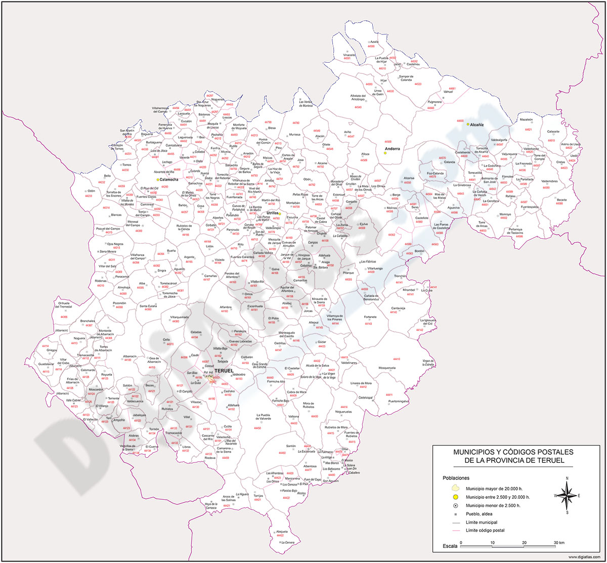
Map of Teruel province with municipalities and postal codes
Map of postal codes of the province of Teruel.
(...) Read more »
Adobe Illustrator, Acrobat PDF

