
55,00 €
15 maps of Spanish provinces with comarcas and municipalities
Digital maps of 15 provinces of Spain with comarcas and municipalty borders and city names. (Cáceres, Badajoz, Albacete, Ciudad Real, Toledo, Alicante, Castellón, Valencia, Murcia, Burgos, León, Sa
(...) Read more »
imagen JPG (250 dpi)
79,00 €
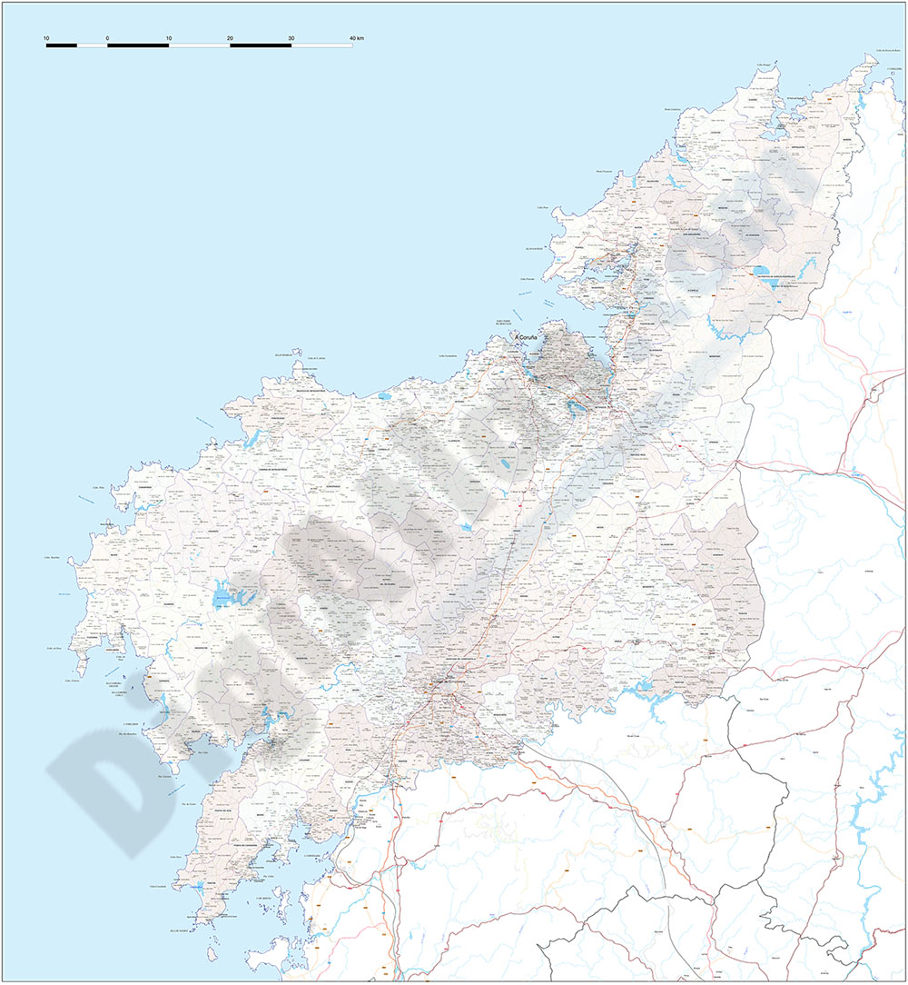
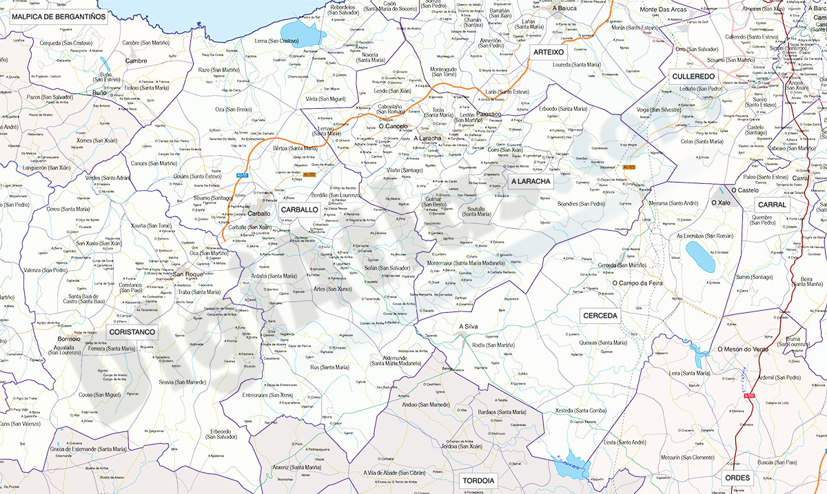
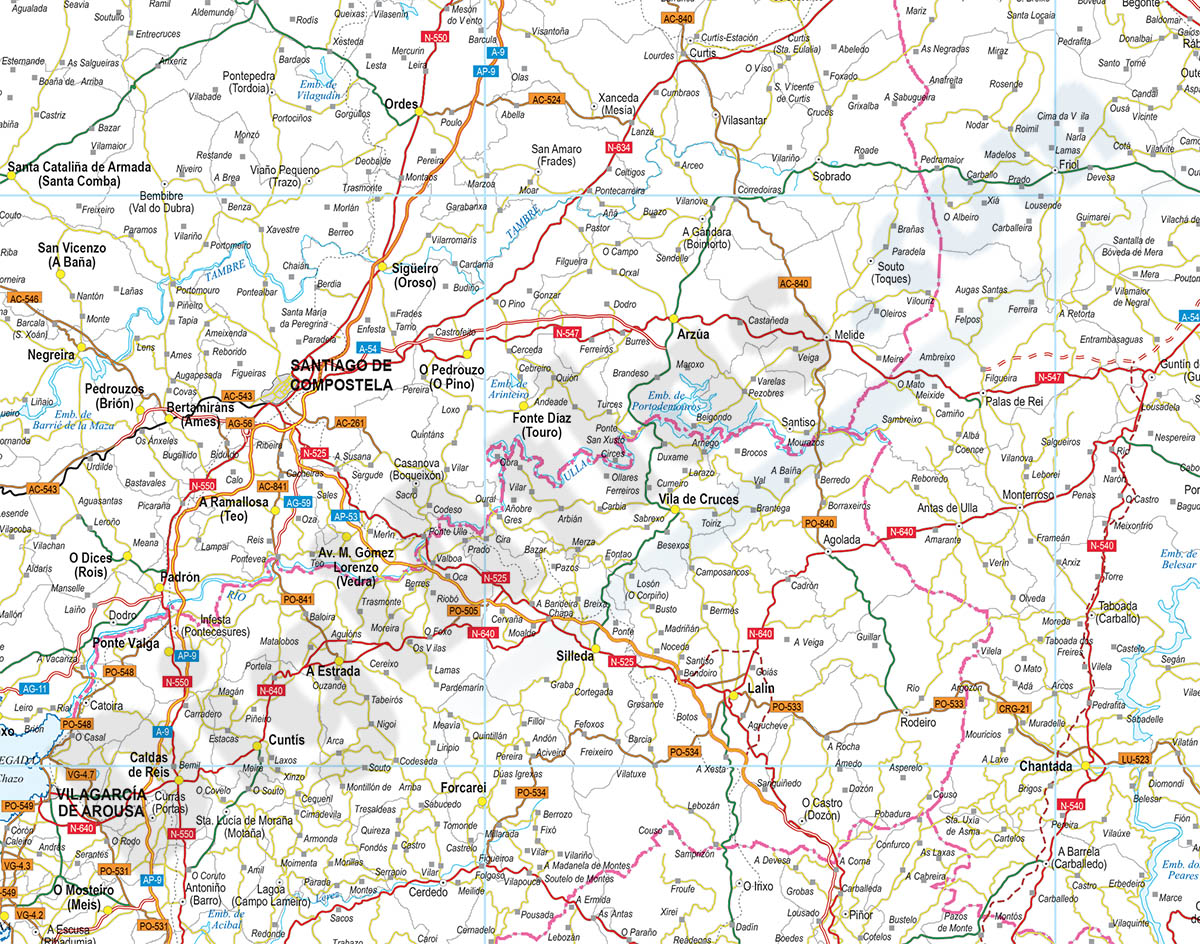
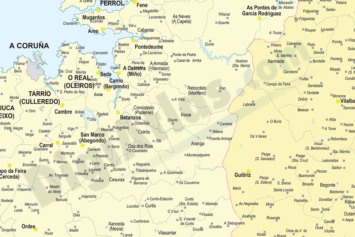
A Coruña (Corunna) - Map of province with parroquias and aldeas
Map of A Coruña province (Galicia, Spain) showing Autonomous Communities, provinces, concellos and parroquias boundaries. Include cities, 'aldeas', highways, major and minor roads, railroad, princip
(...) Read more »
Adobe Illustrator, PDF
59,99 €
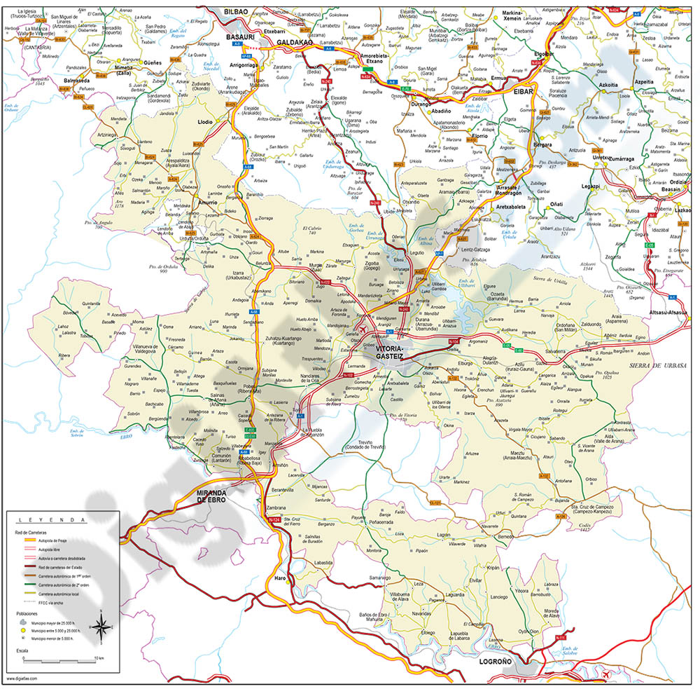
Alava (Araba) - Map of the province
Digital map of the province of Araba/Álava (Basque Autonomous Community)
(...) Read more »
Adobe Illustrator, Acrobat PDF
59,99 €
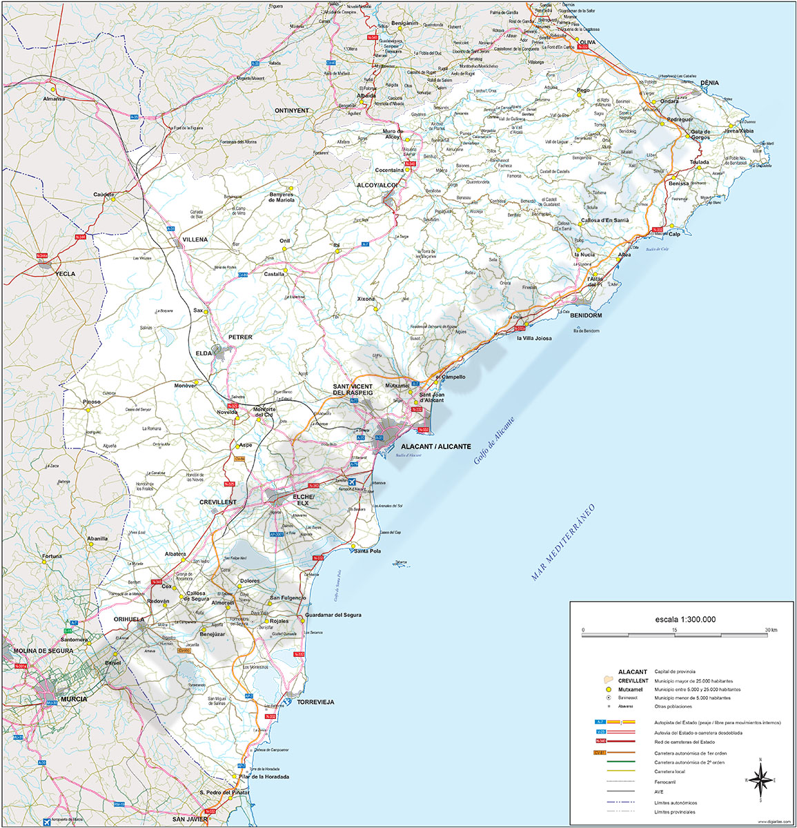
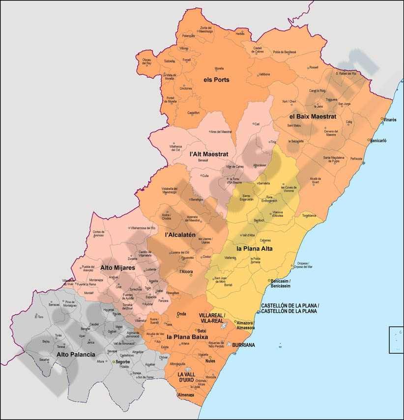
Alicante - Map of province
Vector format spain province map showing community and province boundaries, cities, highways, major and minor roads, railroad, principal rivers and lakes and other relevant political information. Scal
(...) Read more »
Adobe Illustrator, PDF, JPG (300dpi)
59,99 €
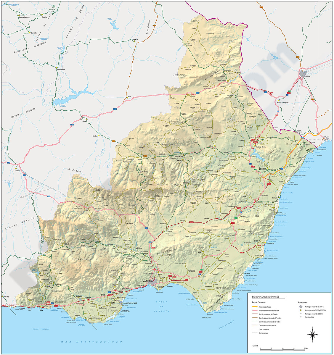
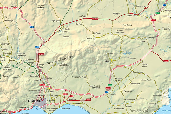
Almeria - Province digital map
Digital map of the Almeria spanish province, showing community and province boundaries, cities, highways, major and minor roads, railroad, principal rivers and lakes and other relevant political infor
(...) Read more »
Adobe Illustrator, PDF
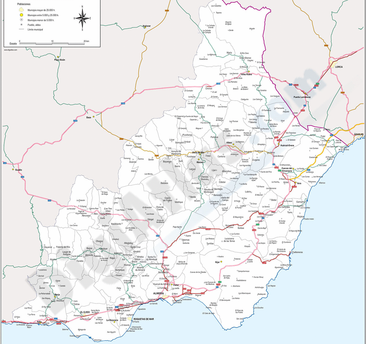
65,00 €
Andalucia provinces with municipalities
Digital maps of the 8 Andalusian provinces
.
Each province is in a separate file and shows the boundaries or municipalities, the capitals, cities and towns grouped according to the number of inhabitants and the main road network (motorways, dual carriageways and regional roads).
The cartography is delivered in Adobe Illustrator and Acrobat PDF vector format, organised in separate layers that can be fully edited or printed directly at the desired size, always with the highest resolution.
The vector format of the files allows, for example, to cut out and enlarge certain areas of the map to create working copies or print them at high quality, hide and/or visualise different layers of information to generate personalised versions of the plans, modify colours and styles to adapt them to your preferences, add more layers of information, such as logos, etc.
See less «
Adobe Illustrator, Acrobat PDF
59,99 €
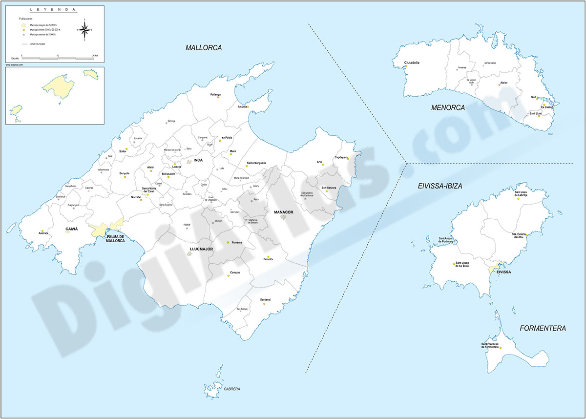
Balearic Islands with municipalities
Digital map of the Balearic Islands (Illes balears) with the limits of the municipalities and their capitals.
(...) Read more »
Adobe Illustrator, Acrobat PDF
59,99 €
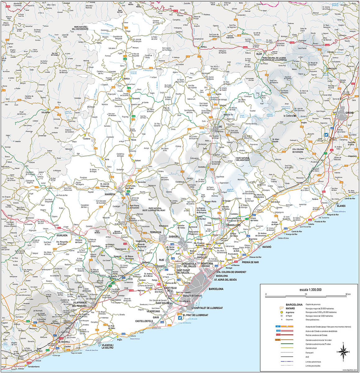
Barcelona - Map of province
Digital map of the province of Barcelona (Catalonia) at a scale of 1:300.000 with detailed geographical and political information. It includes the autonomous, provincial and municipal limits, c
(...) Read more »
Adobe Illustrator, Acrobat PDF
90,75 €
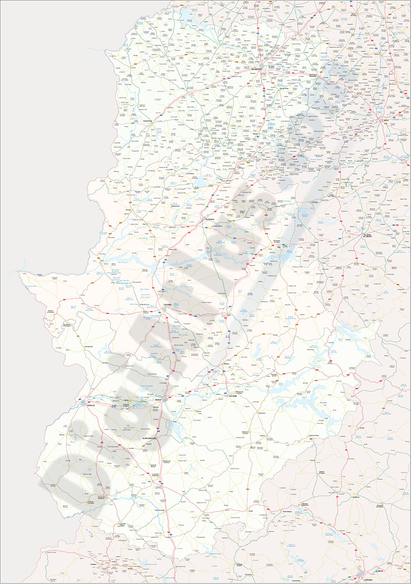
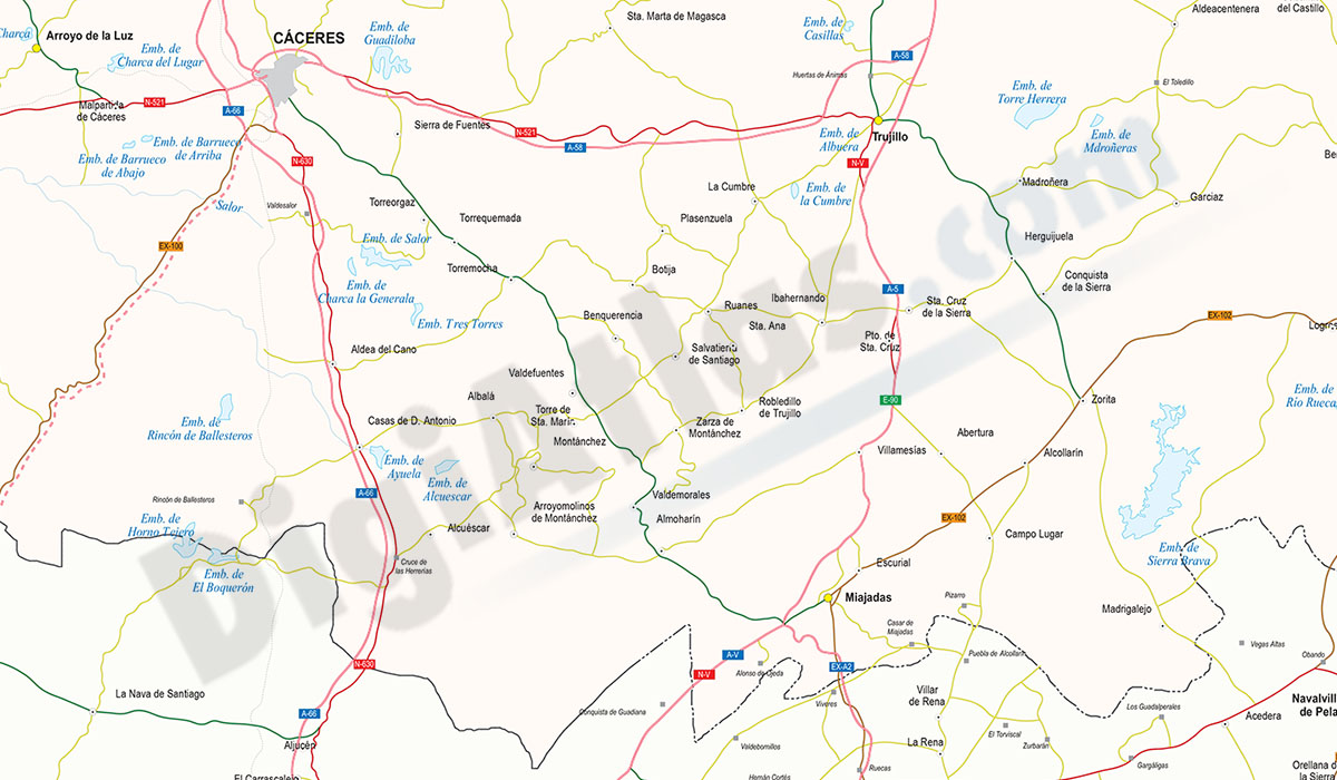
Cáceres-Badajoz-Salamanca provinces (Spain) - vector maps
Digital map of Spanish provinces of Cáceres, Badajoz and Salamanca with administrative borders, municipalities and localities, motorways, highways, national roads, regional and local roads, rail netw
(...) Read more »
Adobe Illustrator, Acrobat PDF
55,00 €
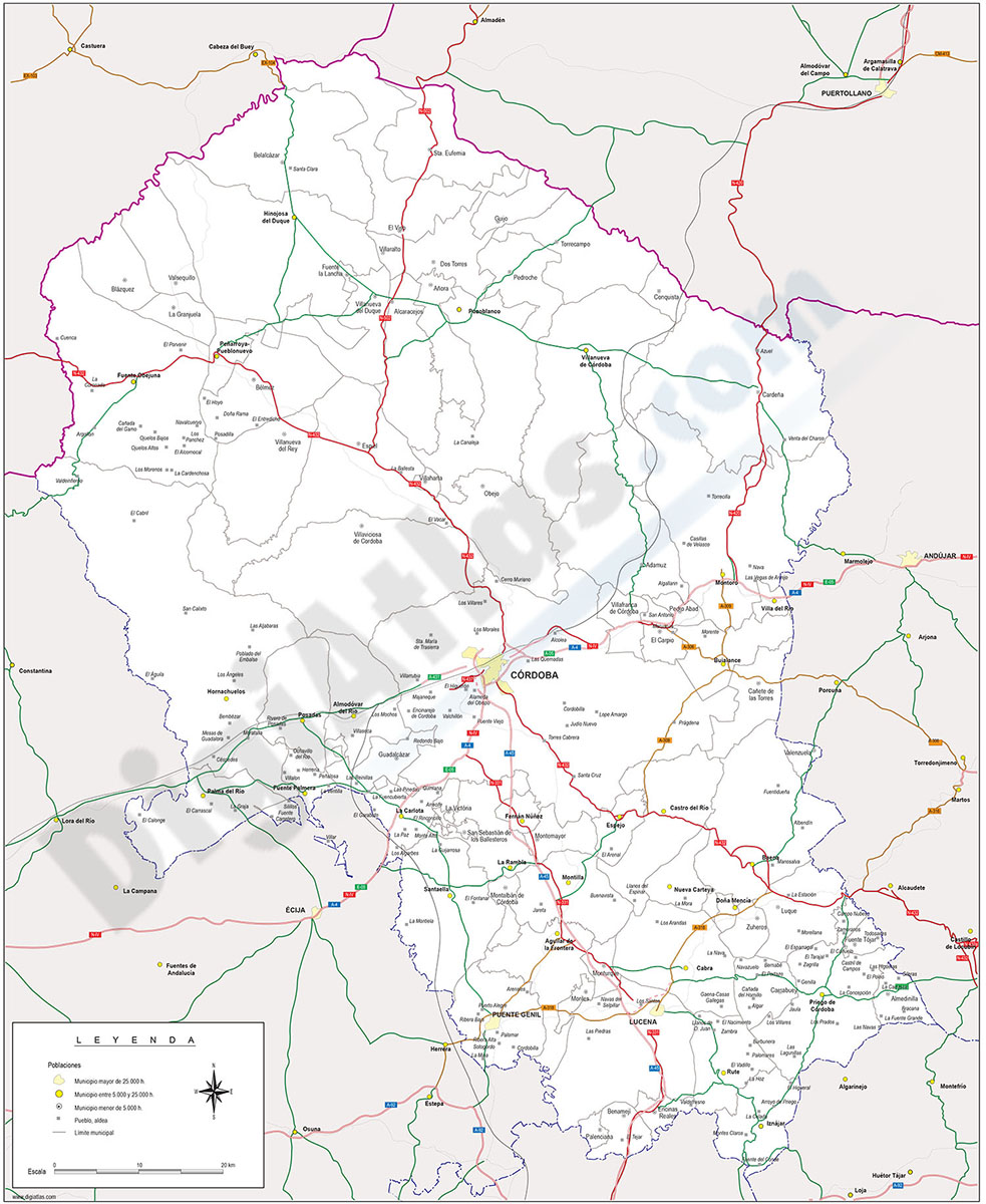
Cordoba province map with municipalities borders and major roads
Map of Cordoba (Cordova) province (Andalucia-Spain) showing municipalities borders, cities and major roads.
Adobe Illustrator, PDF
59,99 €
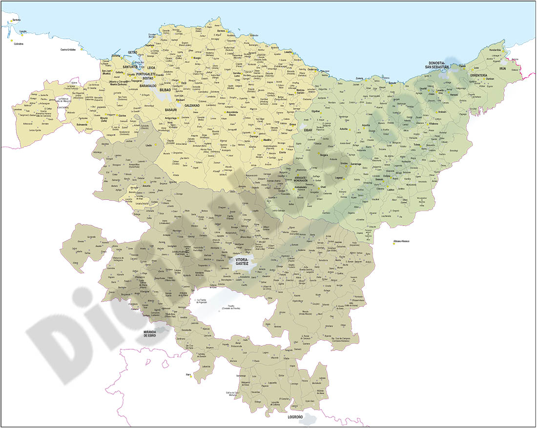
Euskadi map with municipalities borders
Map of Euskadi autonomous community (Spain) showing municipalities borders. Municipality areas of each basque province (Bizkaia, Araba and Gipuzkoa) in a separate color.
Adobe Illustrator, PDF

79,00 €
Galicia (Galizia) Spain autonomous community map
Digital poster size map of Galicia autonomous community (Spain).
(...) Read more »
Adobe Illustrator, Acrobat PDF

59,99 €
Galicia map with municipalities
Digital map of Galicia autonomous community (northwest Spain) with the municipalities (concellos), their capitals and villages.
(...) Read more »
Adobe Illustrator, Acrobat PDF
55,00 €
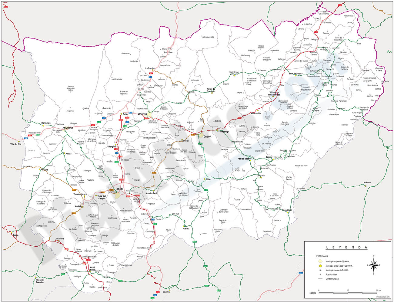
Jaen province map with municipalities
Map of Jaen province (autonomous community of Andalucia-Spain) showing municipalities borders, capitals, towns, cities and major roads.
Adobe Illustrator, Acrobat PDF
79,00 €
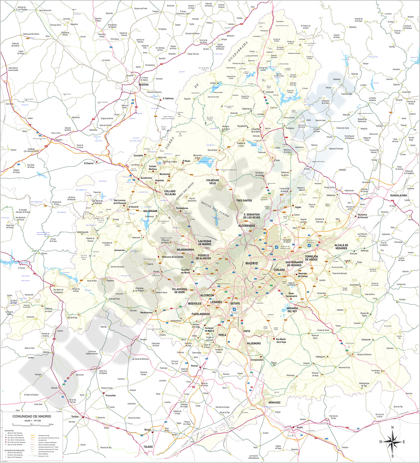
Madrid - detailed map of Community
Digital map of the Community of Madrid at a scale of 1:100,000 with the regional and provincial boundaries, municipalities and towns grouped according to their number of inhabitants, network of motorw
(...) Read more »
Adobe Illustrator, Acrobat PDF
