
55,00 €
Zaragoza municipality - Population by Zip Code
NUMBER OF INHABITANTS BY POSTAL CODE OF THE MUNICIPALITY OF ZARAGOZA.
(...) Read more »
Excel

65,00 €
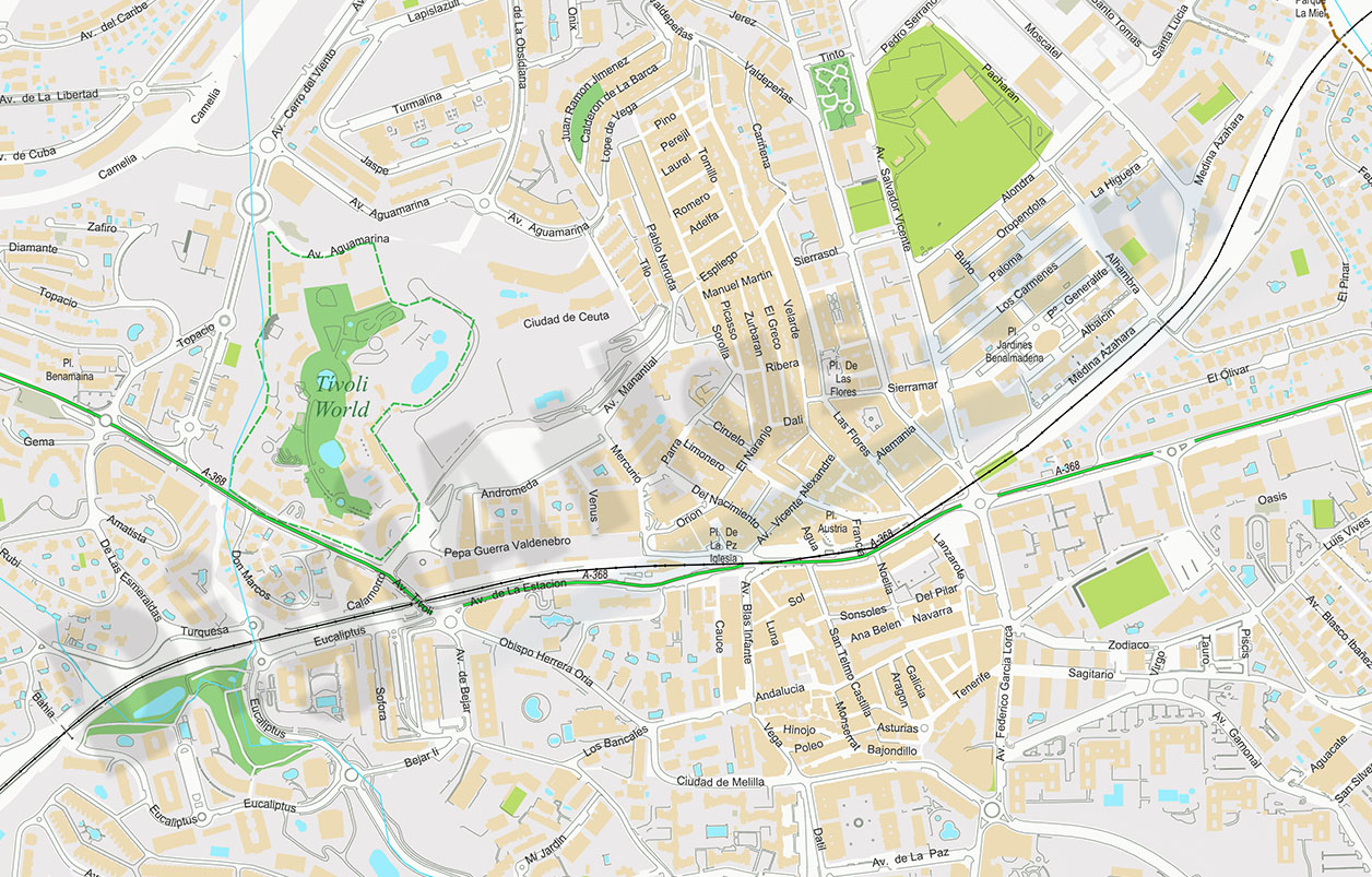
Benalmadena - city map
Digital street map of Benalmádena (province of Málaga, Andalusia) with the delineation of streets and squares, blocks of houses, singular buildings, parks, green areas and names of streets and squar
(...) Read more »
Acrobat PDF
150,00 €
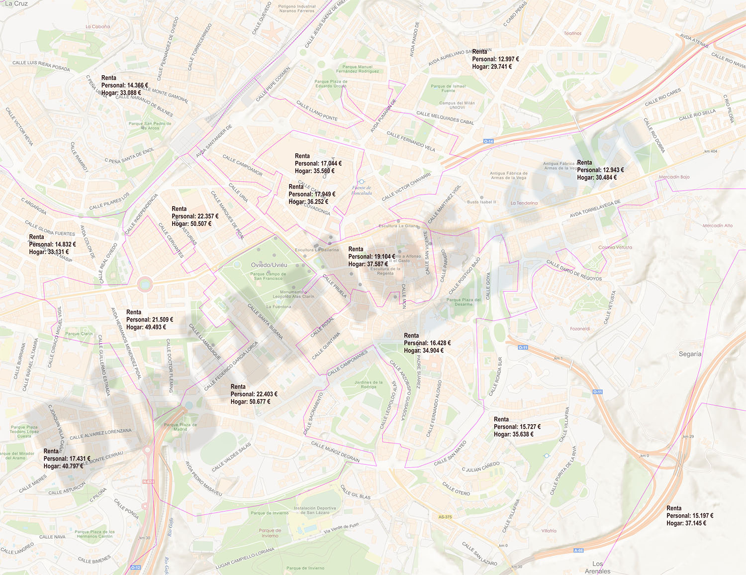
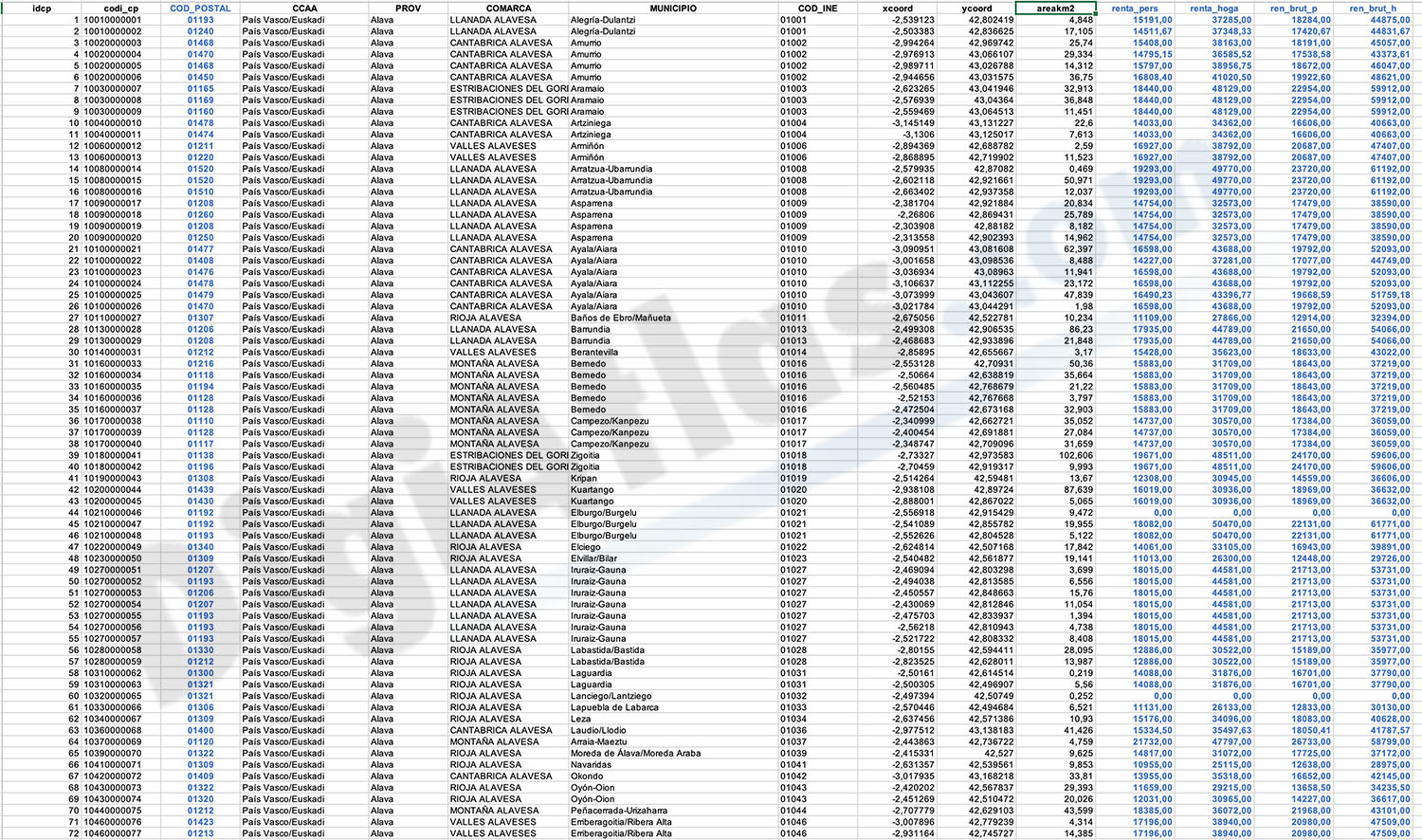
Income and Revenue by Postcode in Spain
Looking to gain valuable insights into income and rental data in Spain? Look no further than our "Excel file with Income and Revenue by Postcode in Spain."
This comprehensive database provides you with the average income and rental figures per person and household for every postal code in Spain. With this information at your fingertips, you can make informed decisions and tailor your strategies to target specific areas.
Don't miss out on this invaluable resource – get your hands on our fichero Excel today and unlock the potential of data-driven success.
This Excel file is the key to understanding income and wealth across the country. With granular data on average and gross income per person and household in each postcode, you can accurately target customers and properties.
Discover which areas have the highest purchasing power, compare living standards by region and optimise your expansion strategy. This valuable database will help you locate lucrative opportunities and avoid costly mistakes.
See less «
Excel
Ask price
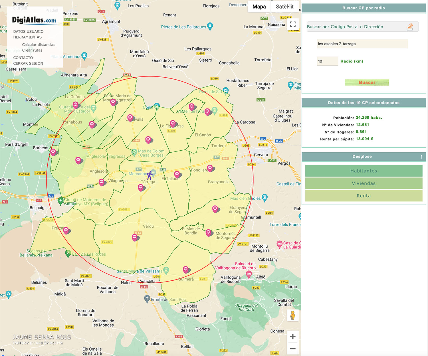
Postal Code Finder by Radio
Postcode finder by radius with demographic information.
(...) Read more »

175,00 €
Population by postcode in Spain
-NUMBER OF INHABITANTS OF EACH ZIP CODE IN SPAIN.
Learn the population data for every zip code in Spain with this comprehensive database.
(...) Read more »
Excel
Ask price
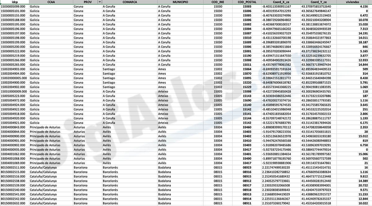
Number of dwellings by postcode in Spain
Number of dwellings by Postal Code
There are 235 municipalities in Spain with more than 25,000 inhabitants and with more than one postal code within their municipal boundaries.
(...) Read more »
Excel

OFFER: 55,00 € | 27,50 €
Sant Andreu de Llavaneres - city map
Street map of Sant Andreu de Llavaneres municipality (Comarca of Maresme, province of Barcelona, Autonomous Community of Catalonia, Spain). Digital map contain separate layers of information with urba
(...) Read more »
Adobe Illustrator, PDF

55,00 €
Avila - city map center
Digital street map of the city centre of Ávila (Autonomous Community of Castile and León - Spain), with the delineation of streets and squares, blocks of houses, parks and green areas, with colours
(...) Read more »
Adobe Illustrator, Acrobat PDF

59,00 €
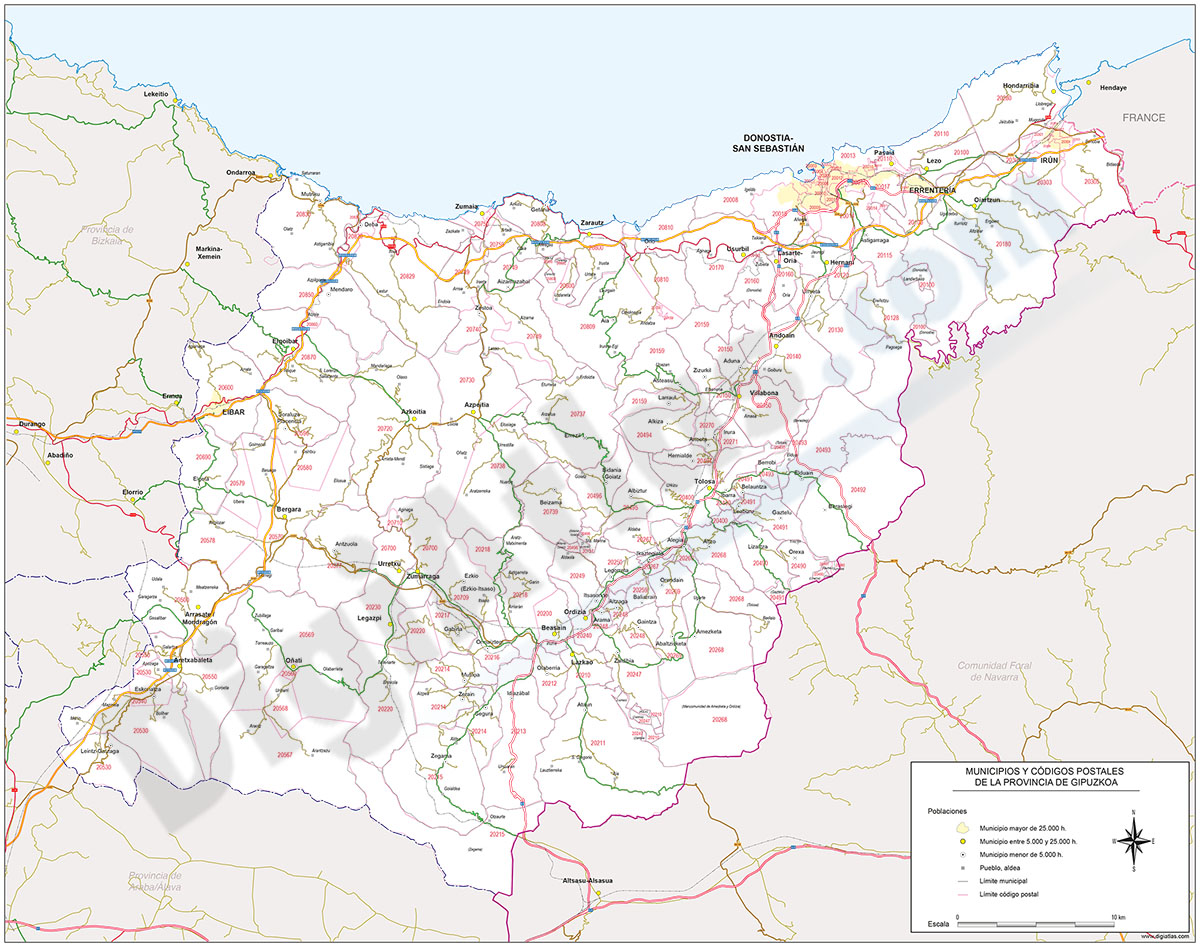
Map of Gipuzkoa province with municipalities and postal codes
Digital map of the province of Gipuzkoa (Basque Country - Spain) with the areas of all 5-digits postal codes, administrative boundaries (state border, autonomous, provincial and municipal boundaries),
(...) Read more »
Adobe Illustrator, Acrobat PDF
OFFER: 59,99 € | 30,00 €
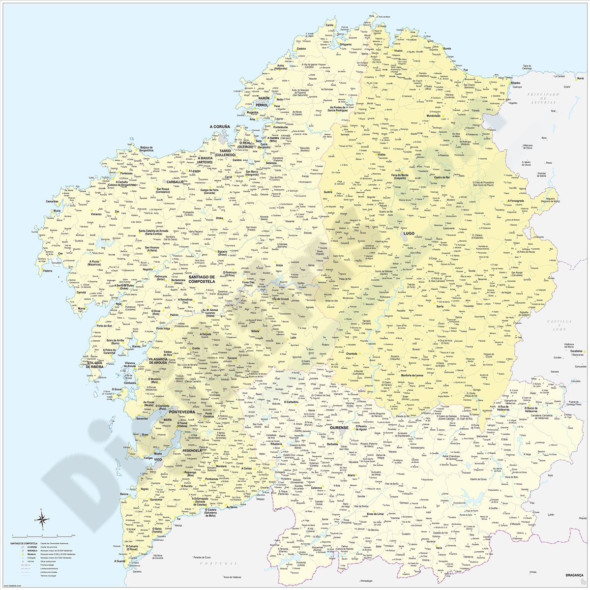
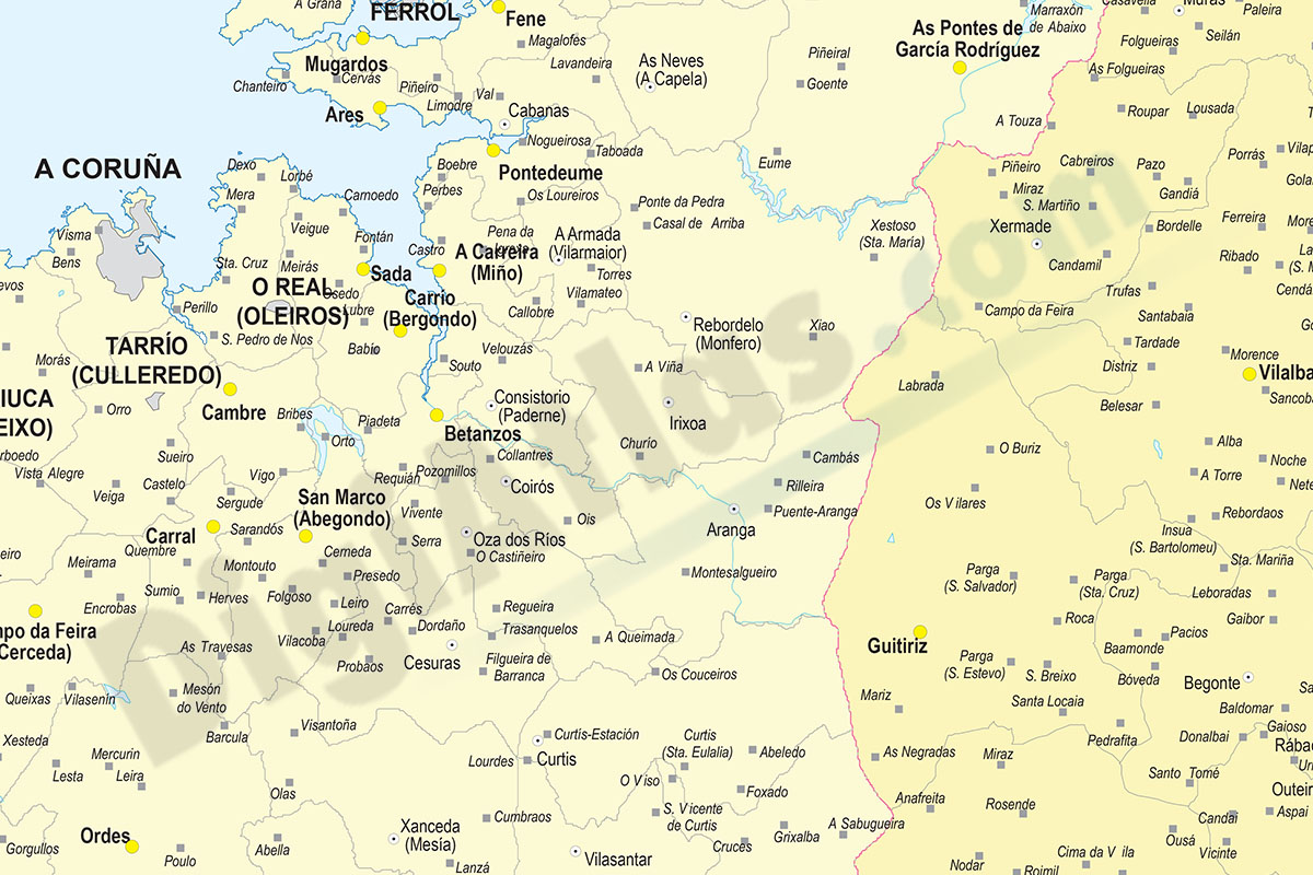
Galicia map with municipalities
Digital map of Galicia autonomous community (northwest Spain) with the municipalities (concellos), their capitals and villages.
(...) Read more »
Adobe Illustrator, Acrobat PDF
59,00 €
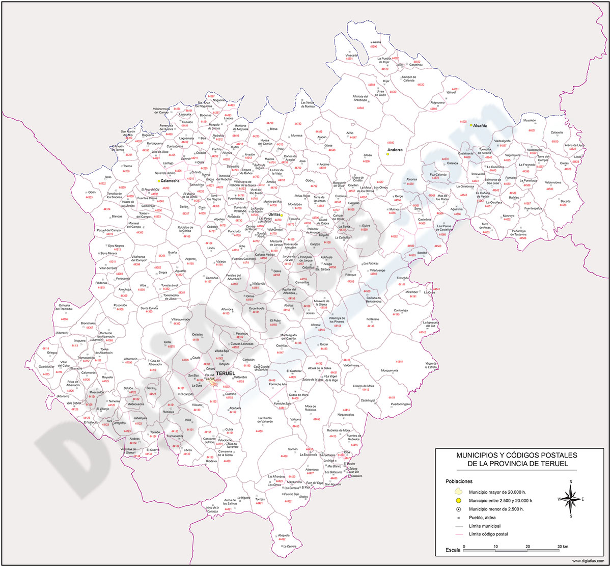
Map of Teruel province with municipalities and postal codes
Map of postal codes of the province of Teruel.
(...) Read more »
Adobe Illustrator, Acrobat PDF
OFFER: 19,95 € | 9,98 €
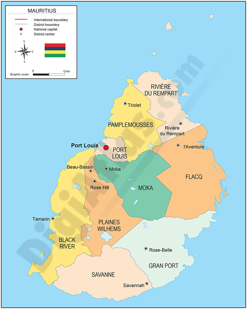
Map of Mauritius
Digital political map of the Republic of Mauritius with the internal administrative division (districts and dependencies), their names and capitals.
(...) Read more »
Adobe Illustrator, Acrobat PDF

350,00 €
Portugal - Population by 7-digit postal code
Excel file with the inhabitants by 7-digit postcodes of Portugal.
(...) Read more »
Excel
275,00 €
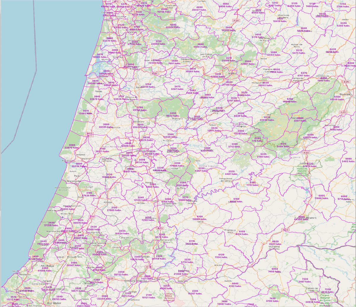
Portugal - population by 4 digit postal codes
Digital map of Portugal postcodes with population data.
(...) Read more »
Shapefile, Excel

125,00 €
Portugal - Excel population by 4-digit postal code
Excel file with the inhabitants by 4-digit postcode of Portugal.
(...) Read more »
Excel
