
45,00 €
Cartagena - Population by postal code
Population by postal code of the municipality of Cartagena (Region of Murcia).
(...) Read more »
Excel

45,00 €
Santa Cruz de Tenerife- Population by postal code
Population data by postcode for the province of Santa Cruz de Tenerife (Canary Islands).
(...) Read more »
Excel

350,00 €
Portugal - Population by 7-digit postal code
Excel file with the inhabitants by 7-digit postcodes of Portugal.
(...) Read more »
Excel

98,00 €
Burgos and La Rioja - inhabitants by postcode
Digital map of the province of Burgos and the autonomous community of La Rioja showing the municipalities, postcode boundaries and the number of inhabitants of each postcode.
(...) Read more »
Adobe Illustrator, Acrobat PDF y Excel
Ask price
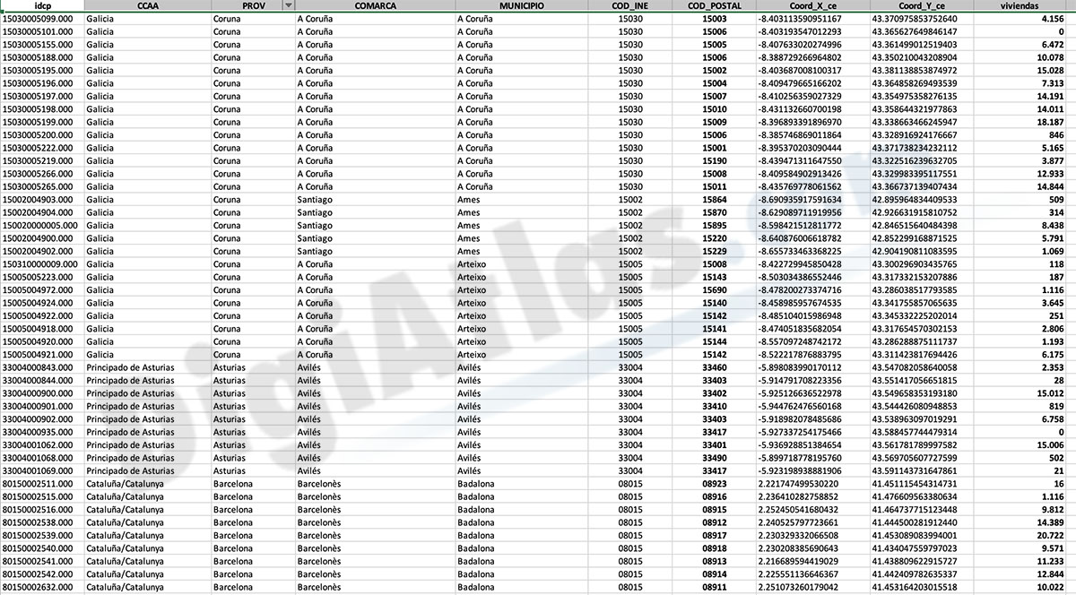
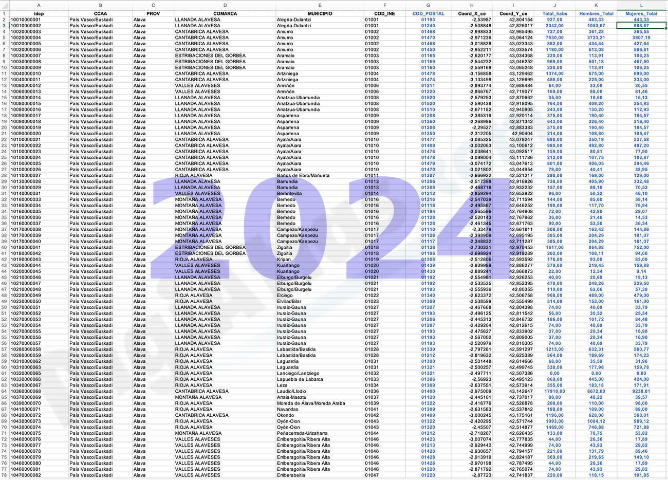
Number of dwellings by postcode in Spain
Number of dwellings by Postal Code
There are 235 municipalities in Spain with more than 25,000 inhabitants and with more than one postal code within their municipal boundaries.
This dataset provides the total number of dwellings in these municipalities organized by postcode. The data comes from the 'Catastro' and the National Statistics Institute (INE) and its most recent census information.
For each of the 235 municipalities, the number of dwellings per zip code has been determined and presented in a single Excel file. The purpose of the dataset is to show the distribution and concentration of housing in the different regions, cities and neighborhoods of these municipalities in Spain. It can provide information on population density, urban development, real estate markets and infrastructure needs.
See less «
Excel
125,00 €
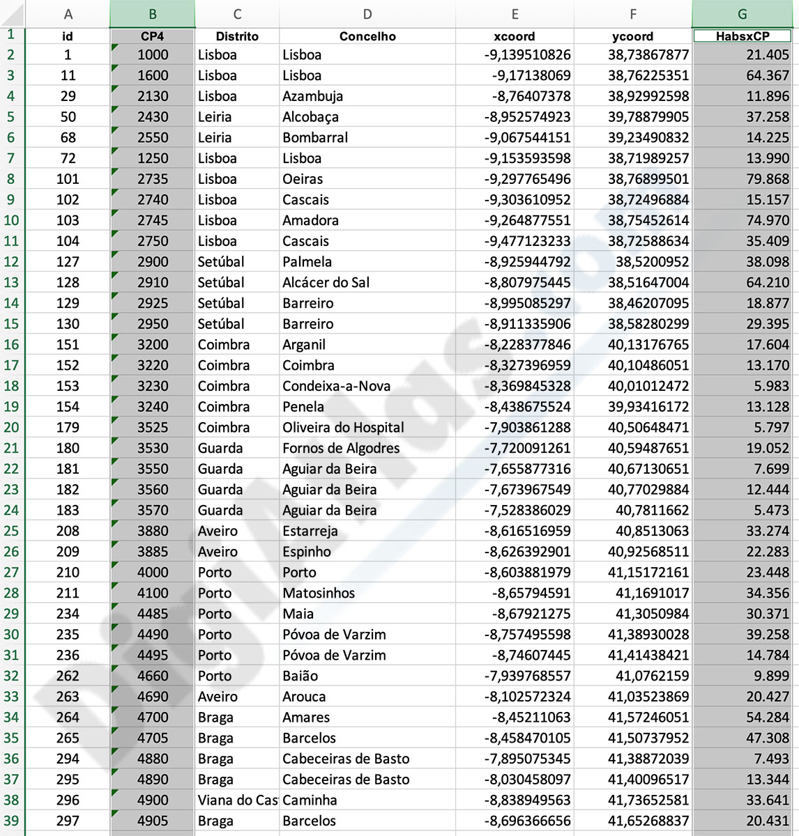
Portugal - Excel population by 4-digit postal code
Excel file with the inhabitants by 4-digit postcode of Portugal.
(...) Read more »
Excel
151,25 €
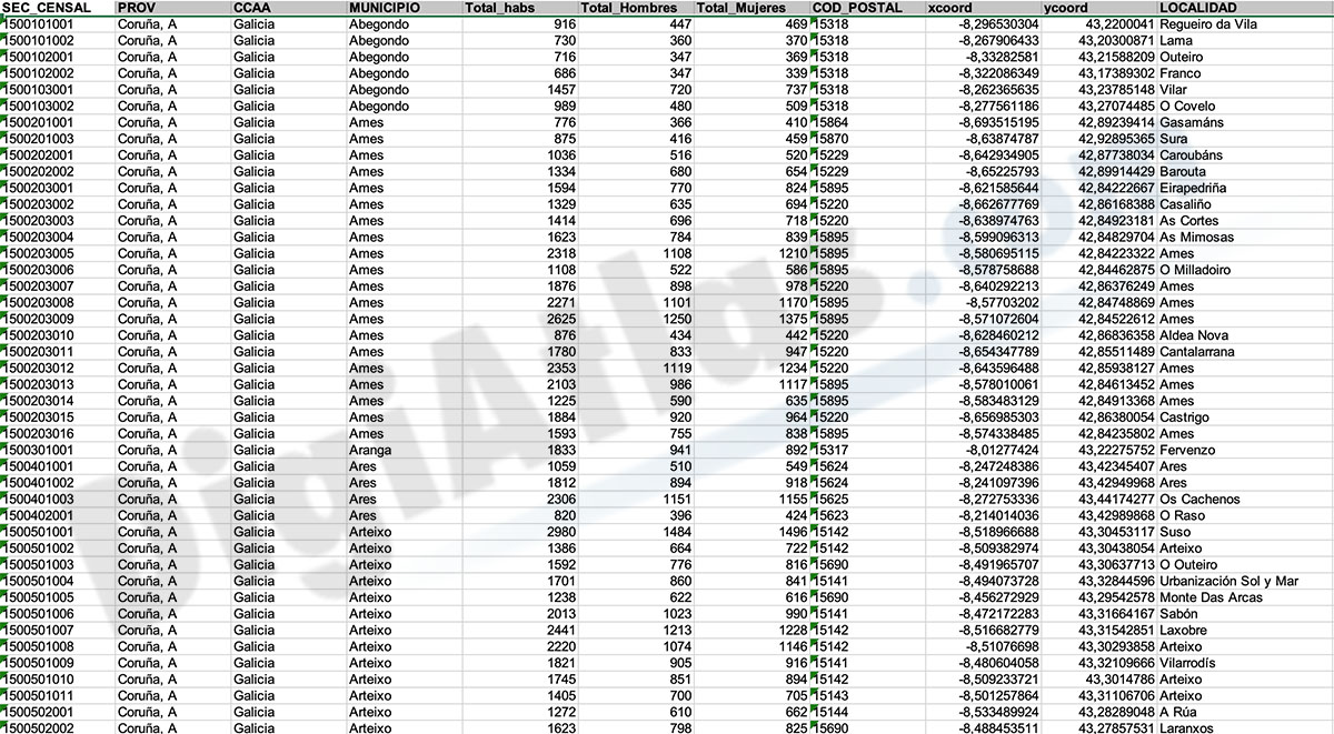
Population by census area of Galicia
Number of inhabitants for each census section in Galicia autonomous community, Spain.
(...) Read more »
Excel, KML
90,75 €
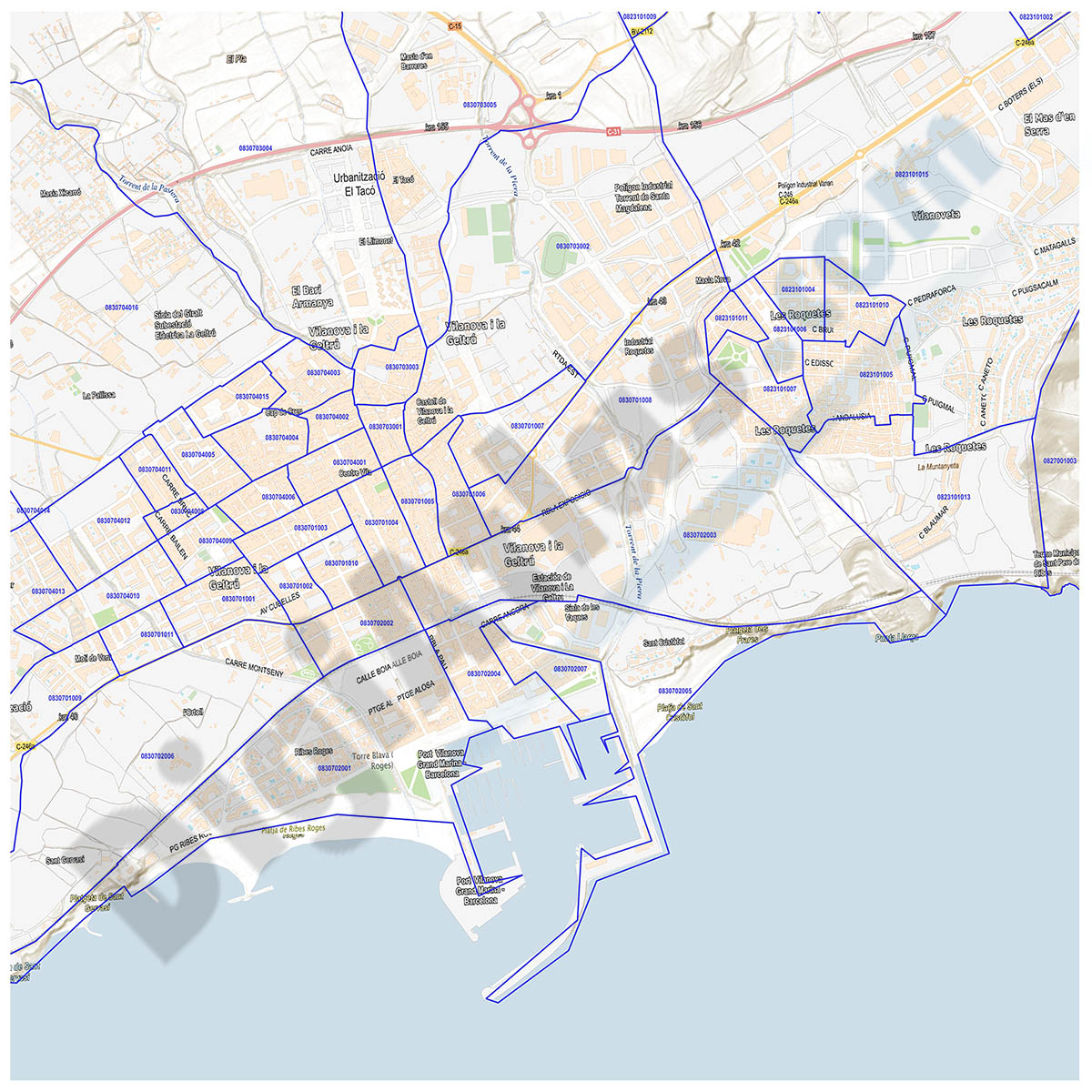
Cartagena and Madrid community - Population by postal code
Historical population data by postal code of the municipality of Cartagena (Region of Murcia) and the Community of Madrid.
Population data from 2017 to 2021.
(...) Read more »
Excel
Ask price
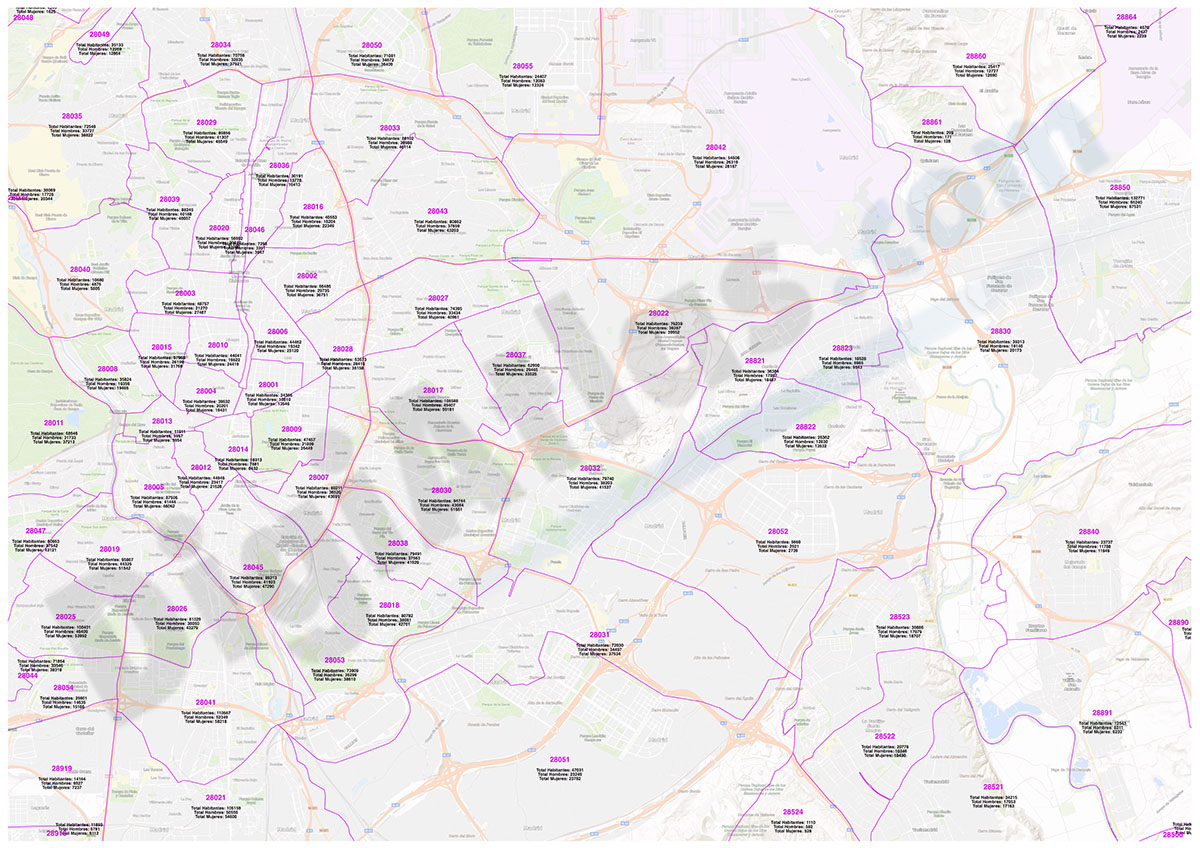
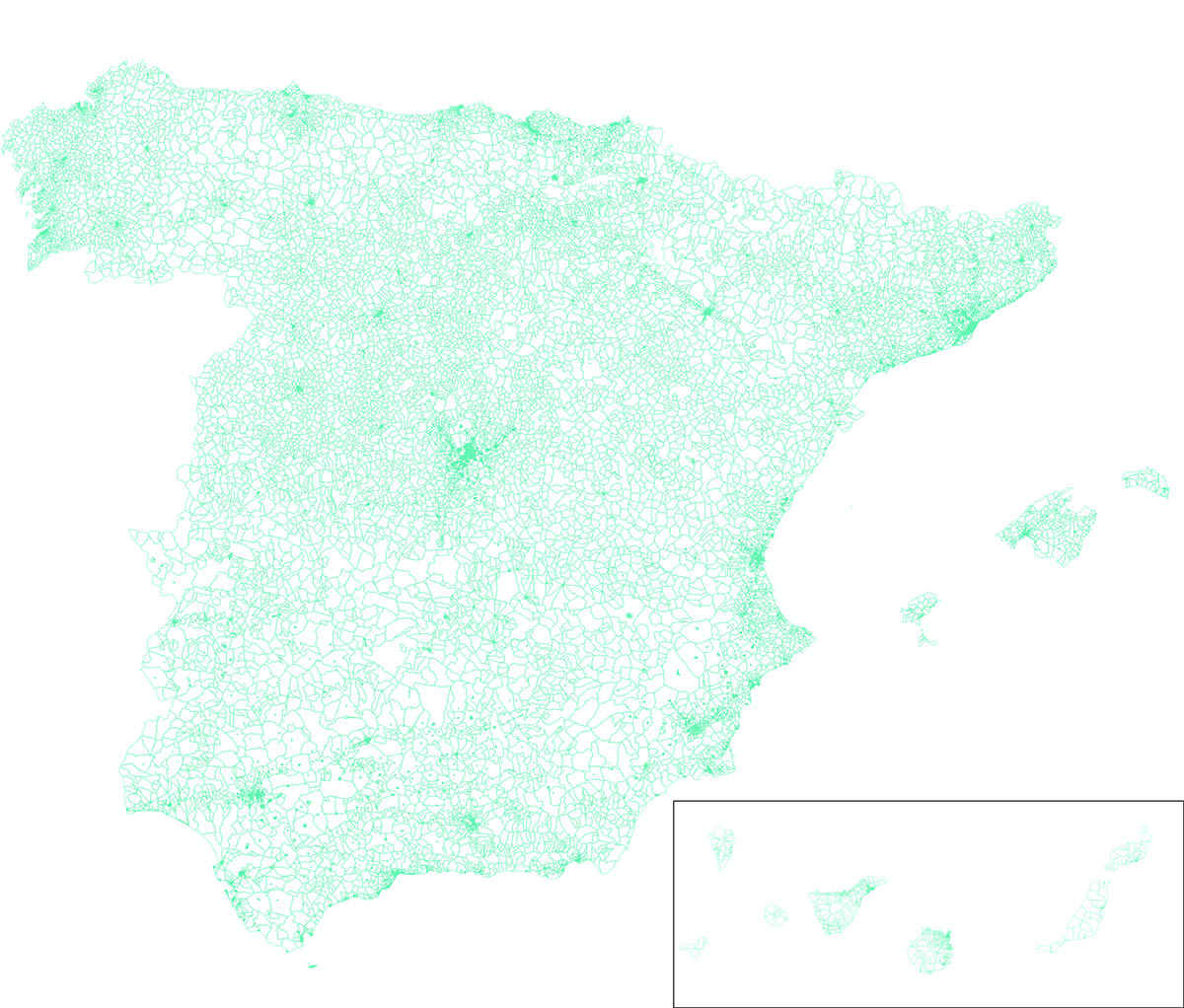
Spanish census sections
-Complete Digital map of Census Sections of whole Spain always 100% up to date.
(...) Read more »
Shapefile (.shp), kml y otros formatos.
78,65 €
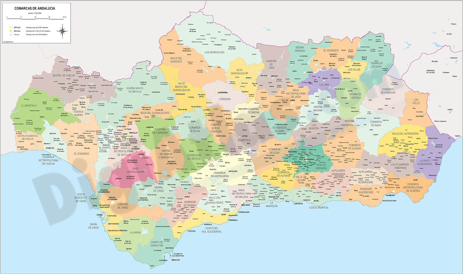
Andalucia - map of comarcas
Digital map of Andalusia (Andalucia autonomous community, Spain) with the comarcas and municipalities in 100% editable vector format.
(...) Read more »
Adobe Illustrator, Acrobat PDF
175,00 €
Population by postcode in Spain
-NUMBER OF INHABITANTS OF EACH ZIP CODE IN SPAIN.
Learn the population data for every zip code in Spain with this comprehensive database.
(...) Read more »
Excel

175,00 €
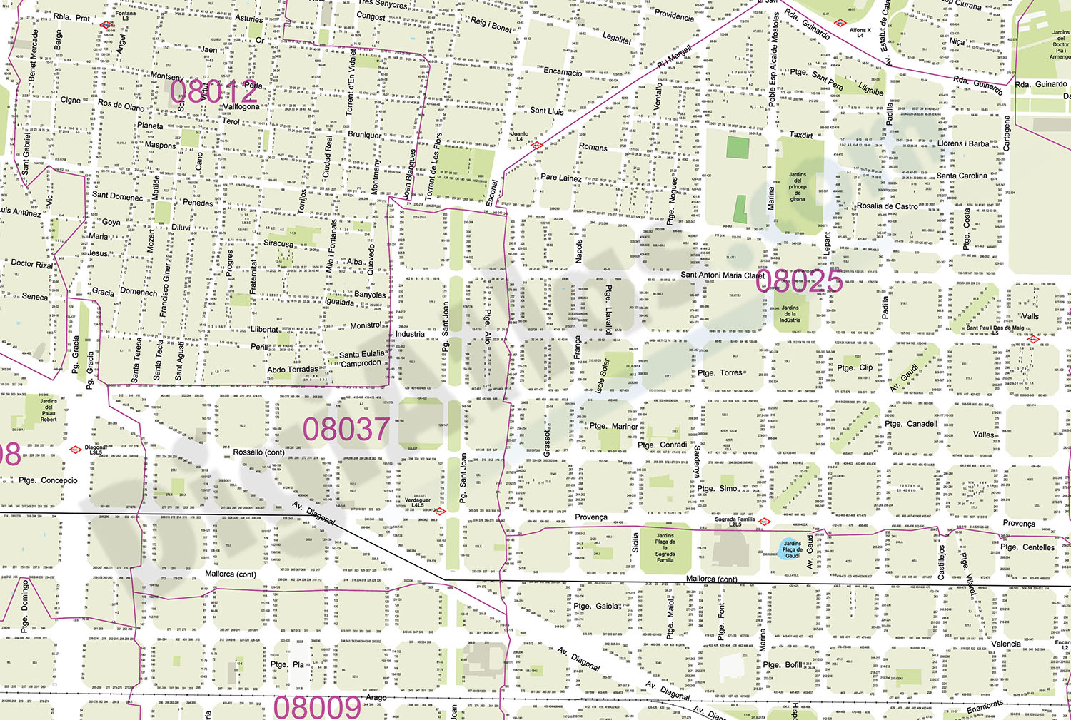
Barcelona - City map with portal numbers
Digital street map of Barcelona with street numbers.
(...) Read more »
Acrobat PDF

OFFER: 98,00 € | 49,00 €
Gijón - city map
Digital street map of Gijón (Principality of Asturias) with urban area delineation, municipal boundaries and street and square names. Poster size map 1414x1000 mm (ISO B0).
(...) Read more »
Adobe Illustrator, Acrobat PDF
98,00 €
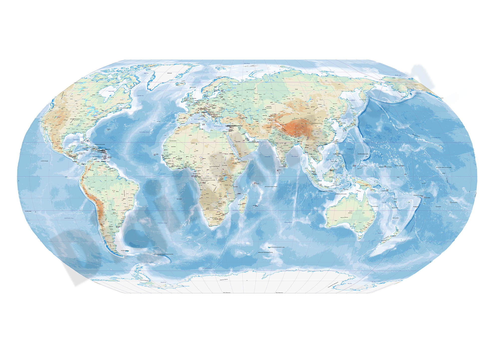
Robinson projected Worldmap centered in Bahrain
Worldmap in Robinson projection centered in Bahrain. Include physical information (colors of topography and bathimetry), country boundaries, capitals, major river and lakes and major cities. Vector fo
(...) Read more »
Acrobat PDF
OFFER: 79,00 € | 39,50 €
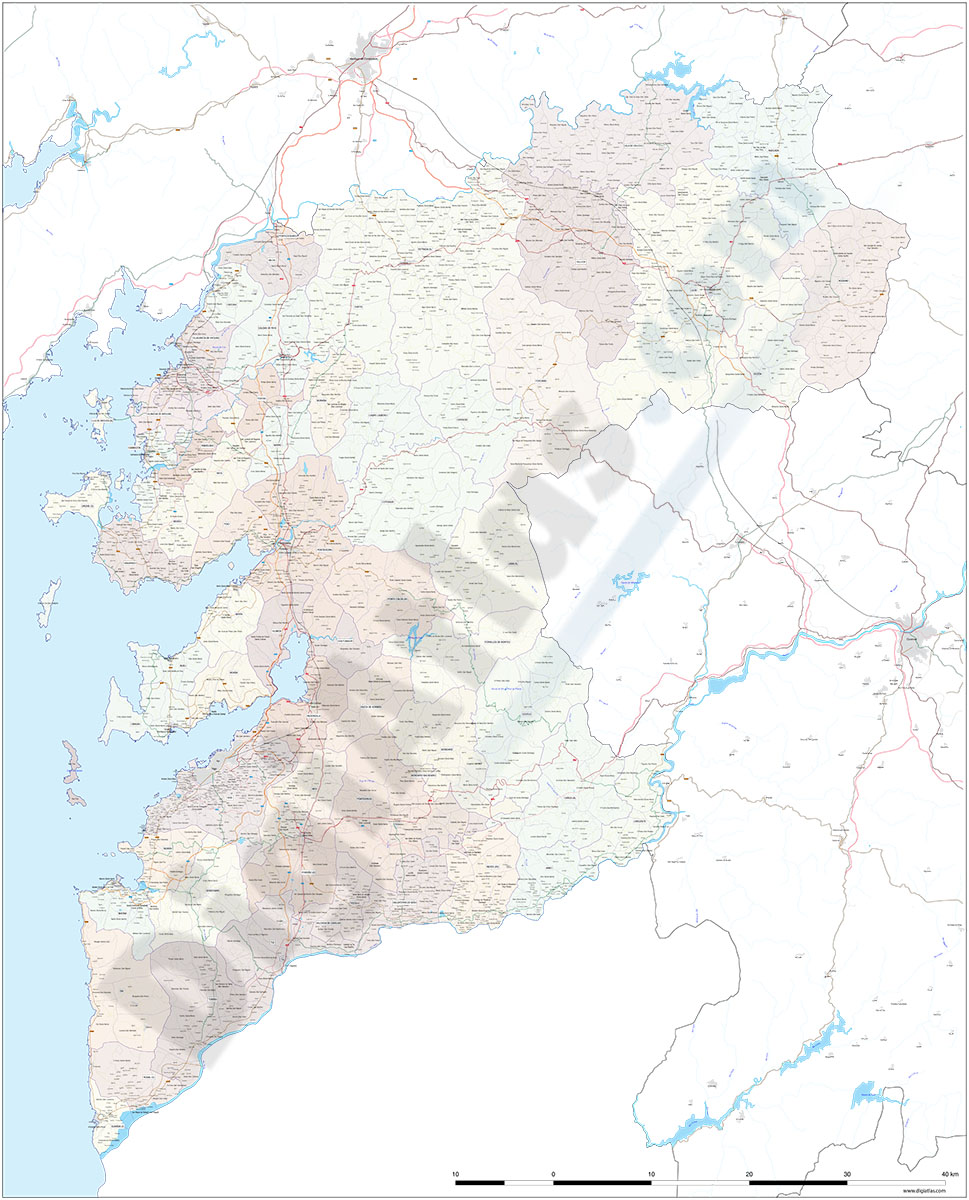
Pontevedra (Galicia, Spain), map of province with parroquias and villages
Map of province of pontevedra (Galicia, Spain) showing Autonomous Communities and provinces limits, concellos and parroquias boundaries, cities, towns, 'aldeas', highways, major and minor roads, railr
(...) Read more »
Adobe Illustrator, PDF, JPG (300dpi)
